Best GPS Unit for Marking Fishing Spots
There's nothing quite like the feeling of reeling in a trophy walleye from Lake Oahe, or landing a beautiful brown trout on a Black Hills stream. But that incredible feeling can quickly turn to frustration when you can't remember exactly where that magic spot was the next time you hit the water. This guide is all about helping you nail down those productive honey holes using the best GPS units, so you can revisit them with confidence and keep those fish stories coming true.
The Indispensable Role of GPS for South Dakota Anglers
South Dakota's fishing landscape is vast and varied, from the sprawling reservoirs of the Missouri River system to the intricate streams of the Black Hills and the numerous glacial lakes in the east. Whether you're chasing walleye, bass, or trout, consistently finding and returning to productive fishing spots is key to success. This is where a reliable GPS unit becomes less of a luxury and more of an absolute necessity.
Imagine spending hours searching for a submerged humpline on Lake Sharpe, finally locating it, and then having a fantastic day catching fish. Without a way to precisely mark that location, you're left guessing on your next trip, wasting precious fishing time trying to re-find it. The Missouri River lakes, in particular, are so massive and feature-rich that subtle changes in depth, rock piles, or current breaks can hold all the fish. A GPS unit lets you pinpoint these nuances. Similarly, for fly fishing on Black Hills streams, marking specific eddies or deep pools can be invaluable, especially if you plan to return after a change in water levels or during a different hatch.
For many of us, fishing isn't just about catching fish; it's about the experience, the memories, and sharing those secret spots (or at least revisiting them yourself!). A GPS takes the guesswork out of returning to those magical places, allowing you to build a personal library of productive waypoints over the years. This digital breadcrumb trail is your personal guide to consistent success and less time searching, more time fishing.
Why Just "Knowing the Area" Isn't Enough
Sometimes anglers tell themselves they know a lake or a river well enough to not need a GPS. They might have a few visual landmarks, a feeling for the bottom, or just rely on memory. While local knowledge is absolutely priceless, it has its limits. Water levels change, especially on reservoir systems. Shoreline features can be obscured by vegetation, ice, or even fog. What looks like a prominent point from the shore might be indistinguishable from the boat.
Consider a scenario where you're out on Lake Francis Case. You found a fantastic rock pile that was holding smallmouth bass. You remember it was "about halfway down the cove on the north side." But then a week later, you return, and the water level is a foot higher, or there's a different boat anchored nearby, or the sun angle completely changes the appearance of the shoreline. Suddenly, "about halfway" feels incredibly vague. A GPS, however, gives you an exact set of coordinates that remain constant regardless of these variables. It eliminates the "maybe" and replaces it with precise, repeatable certainty.
Furthermore, fishing often involves subtle movements and precise boat positioning. Trolling a specific contour line, jigging a small break, or anchoring up-current from a brush pile all require accuracy that visual cues alone often can't provide. A GPS allows you to make these micro-adjustments and stay on the fish, significantly increasing your chances of a successful outing.
Essential Features to Look for in a Fishing GPS Unit
When you're looking to invest in a GPS unit for your South Dakota fishing adventures, you'll quickly realize there's a huge range of options out there. It can be overwhelming! To make an informed decision, it’s helpful to break down the most critical features that truly make a difference on the water. Prioritizing these elements will ensure you get a unit that not only marks your spots but enhances your entire fishing experience.
Think about what really matters when you’re out battling the elements, trying to pinpoint that subtle drop-off on Lake Oahe, or navigating through a series of islands on Lake Vermillion. It’s not just about getting from point A to point B; it’s about understanding the underwater world and having the tools to exploit it.
Detailed Mapping and Cartography
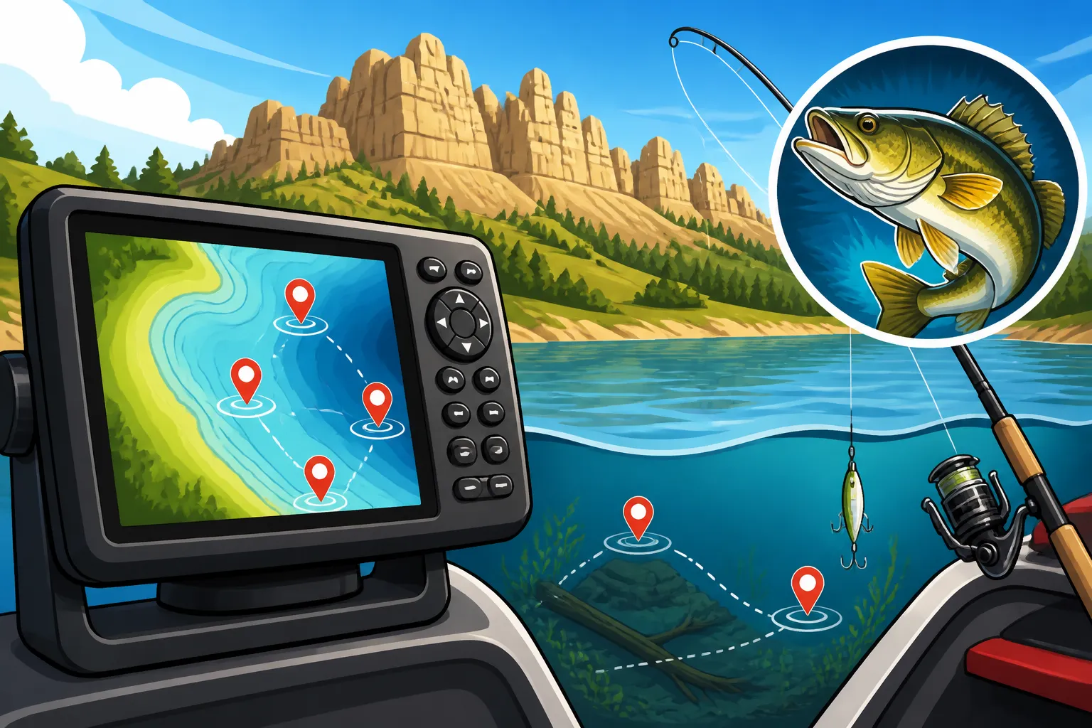
Hands down, the most important feature for a fishing GPS unit is high-quality, detailed mapping. This isn't just about showing you where the shoreline is; it's about revealing the underwater topography that holds the fish. Look for units that come preloaded with high-definition lake maps, often called "lake charts" or "contour maps." These should show depth contours in fine detail, ideally in 1-foot increments, allowing you to see subtle changes in the bottom that walleyes love to hug.
For South Dakota, specifically, you'll want maps that cover the major bodies of water like the Missouri River reservoirs (Oahe, Sharpe, Francis Case, Lewis and Clark), as well as popular glacial lakes like Kampeska, Poinsett, and Bitter Lake. Excellent cartography will also highlight features like submerged roadbeds, creek channels, rock piles, and humps – all prime fish-holding structures. Some advanced mapping systems even offer satellite imagery overlays, which can be incredibly useful for scouting shallow weed beds or identifying historical shoreline features that are now submerged. You can often buy additional map chips or downloads for specific regions or even individual lakes, expanding your unit's utility. Without good maps, your GPS is just a dot on a blank screen; with them, it's a window into the underwater world.
Robust Waypoint and Track Management
What good is finding a spot if you can't save it and easily return? A top-tier GPS unit will offer intuitive and extensive waypoint management capabilities. This means you should be able to:
- Quickly mark a spot: Often with a single button press, allowing you to drop a waypoint the instant you catch a fish or locate promising structure.
- Name and categorize waypoints: Instead of just "Waypoint 001," you can label it "Walleye Rock Pile 20ft" or "Crappie Brush Pile." Many units allow you to use different icons (fish, boat, buoy, etc.) to visually distinguish between types of spots.
- Store a large number of waypoints: Over time, you'll accumulate hundreds, if not thousands, of valuable spots. Ensure the unit has ample memory for this.
- Record tracks: This feature plots your boat's path as you move, which is fantastic for analyzing trolling passes, mapping out new areas, or retracing your route if you get disoriented. Some units even allow you to create a "reverse track" to follow your exact path back.
- Create routes: Plan out a series of waypoints you want to visit in a specific order. This is helpful for covering multiple spots or navigating complex channels.
Imagine you're trolling for walleye on Lake Oahe and hit a productive stretch. Being able to quickly mark the start and end of that pass, then easily save it as a named "Walleye Troll Lane" for later, makes all the difference. This meticulous organization saves time and boosts efficiency on subsequent trips.
Display and User Interface
The display and user interface are your primary means of interacting with the GPS unit, so their quality is paramount. You need a screen that is easily readable in all conditions, from bright South Dakota sunshine to overcast skies, and even in low light at dawn or dusk. Look for:
- Size: Larger screens (7 inches and up) offer more real estate for maps, sonar, and data, reducing clutter and making it easier to interpret information at a glance. However, smaller screens (4-5 inches) are more portable and might be perfect for a kayak or ice fishing setup.
- Resolution: Higher resolution screens provide sharper images and more detail, which is especially important for seeing fine contour lines or distinguishing fish arches on a sonar display.
- Brightness: High-nit displays are crucial for cutting through glare. Many modern units have adjustable backlight settings.
- Touchscreen vs. Buttons: Touchscreens are generally more intuitive and faster to navigate, similar to a smartphone. However, buttons and rotary dials can be easier to operate with wet hands or while wearing gloves, which is a real consideration during colder months or South Dakota Ice Fishing Guide conditions. Some units offer a hybrid approach, combining a touchscreen with a few key buttons.
- Ease of Use: A cluttered or confusing menu system can be a huge frustration. Look for units with an intuitive layout, clear icons, and quick access to frequently used functions. You don't want to be fumbling through menus when you should be focused on fishing.
Durability and Weatherproofing
Fishing can be a rough business, and South Dakota weather can be unpredictable. Your GPS unit needs to be able to withstand splashes, rain, extreme temperatures, and vibrations from boat travel. Look for units with an IPX rating (Ingress Protection rating), which indicates how well it's protected against water and dust. An IPX7 or IPX8 rating is ideal, meaning it can handle submersion for a short period.
Beyond water resistance, consider the overall build quality. A rugged casing, reinforced mounting points, and durable buttons (if applicable) are important for longevity. If you plan to use a handheld unit for wading Black Hills streams or for South Dakota Kayak Fishing Gear Guide, ensure it's built to take a tumble. Nobody wants their expensive electronics failing them when they're miles from the boat ramp or deep in a remote fishing spot.
Battery Life and Power Options
For units that aren't hard-wired into a boat's electrical system, battery life is a crucial consideration. Handheld GPS units, in particular, need to last for a full day (or more) of fishing. Look for models with:
- Long battery life: Check the manufacturer's stated battery life and consider carrying spare battery packs or power banks.
- Replaceable batteries: Being able to swap in fresh AA or AAA batteries in the field can be a lifesaver.
- External power options: Many handheld units can be powered or charged via a 12V adapter or USB, giving you flexibility.
If you're buying a larger, boat-mounted unit, it will typically run off your boat's battery. In this case, consider the unit's power draw, especially if you have multiple electronics, to ensure your battery can handle the load for extended periods on the water.
Types of GPS Units for Anglers
Just like there are different fishing techniques for different species, there are various types of GPS units tailored to different angling styles and needs. Understanding these categories will help you narrow down your choices and find the perfect match for how you fish in South Dakota. Each type has its own set of advantages and disadvantages, so it's not a one-size-fits-all situation.
From the simplicity of a standalone device to the powerhouse capabilities of a combo unit, or the grab-and-go convenience of a handheld, there’s an option out there for every angler. Even your smartphone can get in on the action, though with some caveats.
| GPS Unit Type | Pros | Cons | Ideal Use Cases |
|---|---|---|---|
| Standalone GPS | Focused function, often simpler interface, potentially lower cost | Lacks sonar, radar, or other integrated features; can take up dashboard space if used with separate fish finder | Budget-conscious anglers, those who prefer separate components, or as a backup unit. |
| GPS/Fishfinder Combo | All-in-one solution, integrated mapping and sonar, fewer cables, space-saving on dashboard | Higher initial cost, can be more complex to learn, potential single point of failure | Most powerboat anglers on large reservoirs (e.g., Lake Oahe, Lake Sharpe), serious tournament fishermen, those wanting comprehensive data on one screen. |
| Handheld GPS | Portable, long battery life, rugged, easy to use off the boat | Smaller screens, less detailed mapping, often no sonar (unless specialized), can be harder to see on a moving boat | Kayak fishing, canoe fishing, shore fishing, South Dakota Ice Fishing Guide, hiking to remote streams, backup navigation. |
| Smartphone/Tablet Apps | Cost-effective (if you already own device), familiar interface, often cloud-based mapping updates | Battery drain, not always waterproof/durable, screen glare, can be difficult to mount securely, calls/notifications can interrupt | Casual anglers, backup mapping, budget option, pre-trip planning from home. |
GPS/Fishfinder Combo Units
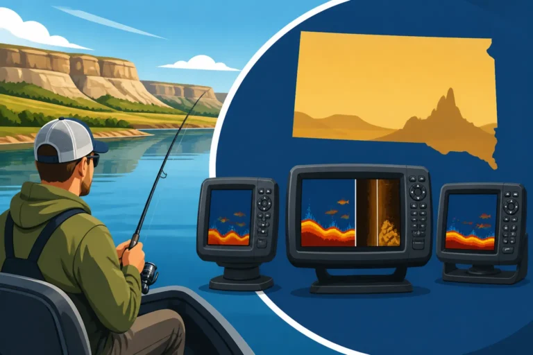
For most serious boat anglers on South Dakota's big waters, a GPS/fishfinder combo unit is often the top choice. These units integrate a powerful GPS plotter with advanced sonar capabilities (traditional 2D sonar, Down Imaging, Side Imaging, and sometimes even Live Sonar), all displayed on a single screen. This integration means you can see your boat's position on a detailed map, mark waypoints, and simultaneously view what's directly beneath and to the sides of your boat.
The benefit of these units is immense. You can troll a contour line on Lake Oahe, see baitfish schools on your sonar, mark that exact location, and then instantly see how it relates to the underwater structure on your map. Brands like Lowrance, Humminbird, and Garmin are leaders in this space, offering a wide range of models at various price points. You can find these advanced units at sporting goods stores like Bass Pro Shops or even online through Amazon, often with various transducer options depending on your specific needs. While the upfront cost can be higher, the comprehensive view of your fishing environment they provide is invaluable for locating and catching fish.
Handheld GPS Devices
Handheld GPS units are the workhorses of versatility. They're compact, usually very rugged, and designed for portability. These are excellent choices for anglers who:
- Fish from kayaks or canoes: Their smaller size and often waterproof design make them perfect for compact watercraft.
- Ice fish: A handheld unit is easy to carry in a bucket or pocket, allowing you to walk directly to a marked waypoint on the ice. They integrate well with specific ice fishing transducers or flasher units.
- Shore fish or wade: If you're exploring the banks of the James River for catfish or wading a Black Hills trout stream, a handheld unit allows you to mark productive eddies, log your path, and avoid getting lost.
- Need a backup: Even if you have a primary boat-mounted unit, a handheld can serve as a reliable backup navigation tool.
While handhelds typically have smaller screens and may not offer the same level of cartographic detail or sonar integration as larger combo units, their portability and durability make them incredibly valuable for specific fishing scenarios in South Dakota. Many come with preloaded base maps, and you can often add more detailed topo or lake maps if needed.
Standalone GPS Units
Before the rise of integrated combo units, standalone GPS plotters were a staple. These units focus solely on navigation: showing your position on a map, marking waypoints, and creating routes. They don't include sonar capabilities.
While less common as a primary unit today, a standalone GPS can still be a good option for:
- Budget-conscious anglers: They are generally less expensive than combo units.
- Those who already have a fishfinder: If you have an older, reliable fishfinder and just need a modern GPS with good mapping, a standalone unit can be a cost-effective upgrade.
- Simplicity seekers: Without the added complexity of sonar settings, these units are often very straightforward to operate.
For an angler who primarily relies on visual cues or basic sonar for fish detection but wants precise waypoint navigation, a standalone unit can be a practical choice. Just remember it won't give you any insight into what's happening directly beneath your boat.
Smartphone and Tablet Fishing Apps
In recent years, fishing apps for smartphones and tablets have exploded in popularity. Many offer detailed mapping, waypoint marking, and even social features to share spots (if you dare!). Apps from companies like Navionics, C-MAP, and Fishing Hot Spots provide excellent cartography for South Dakota lakes and rivers.
The advantages are clear: you likely already own the device, the interface is familiar, and updates are easy. However, there are significant drawbacks. Smartphone screens can be hard to see in direct sunlight, battery life can be a major issue, and most aren't truly waterproof or built for the rigors of fishing. Plus, calls and notifications can be disruptive. While a great tool for planning trips at home or as an occasional backup, they often fall short as a primary navigation tool for serious anglers. They are best used in conjunction with a dedicated, rugged GPS unit, especially when out on large bodies of water or in adverse weather.
Choosing the Right GPS for Your South Dakota Fishing Adventures
Deciding on the "best" GPS unit isn't about finding the most expensive or feature-packed device; it's about finding the one that perfectly aligns with your specific fishing style and the unique demands of South Dakota's waters. Just like you wouldn't use a fly rod to jig for walleye, you wouldn't pick a tiny handheld unit if you spend all your time trolling the main lake basin of Lake Sharpe. Let's break down how to make that decision.
Consider the environment, the species you target, and how you actually get to your fishing spots. The Black Hills streams present entirely different challenges than the wide-open expanse of Lake Oahe. Your perfect GPS solution will reflect these differences.
Tailoring Your Choice to Your Fishing Style
Your fishing method is perhaps the biggest determinant of which GPS unit will serve you best.
-
Powerboat Anglers (Walleye, Bass, Salmon): If you spend most of your time in a bass boat, walleye boat, or pontoon, especially on the Missouri River reservoirs like Lake Oahe or Lewis and Clark Lake, a GPS/fishfinder combo unit is almost certainly your best bet. The ability to simultaneously view detailed contour maps and advanced sonar (like Side Imaging to scout structure off to the sides or Down Imaging for direct detail beneath) is a game-changer. Look for units with large, bright screens (7 inches or more) that are easy to see from the helm or casting deck. These units often come with robust mounting options that can handle the chop of a windy day on a big lake. They integrate seamlessly with your boat's power system and potentially a trolling motor, allowing for incredible control and precision when marking and returning to spots. For detailed South Dakota Walleye Fishing Guide information, these combos are invaluable.
-
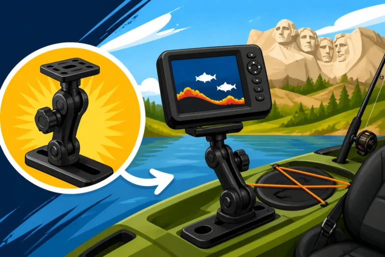
Kayak and Canoe Anglers: Portability and waterproof durability are paramount here. A rugged handheld GPS or a smaller GPS/fishfinder combo (often 4-5 inch screens) is ideal. Consider units that are easy to mount and unmount, and that can withstand splashes or even accidental submersion. Battery life is also crucial if you're out for a full day without a boat battery to tap into. Many kayak anglers also look for units with built-in transducers that can be easily mounted to the hull or transom of their kayak. Check out options at Bass Pro Shops, as they often have specific marine electronics sections for smaller crafts.
-
Shore and Wading Anglers: For those who enjoy bank fishing for catfish on the Big Sioux River or wading the Rapid Creek for trout, a handheld GPS is the most practical choice. It's lightweight, easy to carry in a pocket or on a lanyard, and often has excellent battery life. You might not need ultra-detailed lake charts, but good topographic maps or stream data can be very useful for navigating unfamiliar areas and marking productive spots you discover on foot. Some even use smartphone apps for this purpose, but again, be mindful of battery and durability.
-
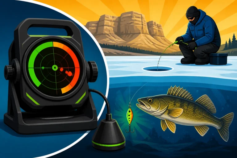
Ice Anglers: When the lakes freeze over, your needs shift. While dedicated ice fishing flashers are popular for viewing fish directly beneath the hole, a handheld GPS is incredibly useful for navigating to your spot on the ice, especially in low light or whiteout conditions. Many ice anglers combine a handheld GPS with their flasher or opt for a portable all-in-one ice fishing specific combo unit that includes a GPS, mapping, and a traditional flasher display. This allows you to walk straight to your stored "Walleye Hump" waypoint on Lake Thompson without wandering around. Make sure the unit is rated for cold temperatures and can be operated with gloves, which might lean you towards a button-operated model over a touchscreen for your South Dakota Ice Fishing Guide adventures.
Budget Considerations and Where to Look
GPS units, especially high-end combo units, can represent a significant investment. However, there are excellent options available across all price points.
- Entry-level (handhelds or basic combos): You can find reliable standalone handhelds or smaller, simpler GPS/fishfinder combo units that will effectively mark waypoints and show basic maps. These are often perfect for getting started without breaking the bank.
- Mid-range (feature-rich combos): This is where you'll find units with larger screens, more advanced sonar technologies (like Side Imaging), and often better preloaded mapping. Many serious anglers find their sweet spot in this category, getting a great balance of features and value.
- High-end (premium combos): These are the flagship models with the biggest, highest-resolution screens, all the latest sonar technologies, networkability with other boat electronics (like radar or autopilots), and often the most extensive preloaded mapping options. They offer unparalleled clarity and control for those who demand the absolute best.
When it's time to purchase, you have several options. Large outdoor retailers like Bass Pro Shops are fantastic for getting hands-on with different models, comparing screen sizes, and talking to knowledgeable staff. They often have demo units on display. Online retailers like Amazon also offer a vast selection, often with competitive pricing and detailed customer reviews that can provide real-world insights into how a unit performs. Before buying, always check the manufacturer's website for the most up-to-date specifications and ensure the unit comes with the mapping you need for your chosen South Dakota fishing waters. Don't forget to account for any additional map cards or transducers that might be necessary.
Ultimately, the best GPS unit for marking fishing spots in South Dakota is the one that fits your budget, enhances your specific fishing style, and helps you unlock more consistent success on the water. It's an investment that pays dividends in saved time, reduced frustration, and most importantly, more fish in the net. Knowing How to Mark Waypoints on a Fish Finder effectively will make any unit you choose more powerful.
Maximizing Your GPS Unit's Potential
Getting a GPS unit is just the first step; truly mastering its capabilities can dramatically improve your fishing success. These devices are powerful tools, far beyond simply marking a spot where you caught a fish. By understanding how to use them proactively and integrate them into your overall fishing strategy, you'll gain a significant edge on South Dakota's diverse waterways.
Think of your GPS not just as a location tracker, but as a digital logbook and a scouting assistant. It helps you build a detailed history of what worked, when, and where, guiding your future decisions on the water.
Strategic Waypoint Usage
Don't just mark "fish caught here." Be strategic with your waypoints!
- Mark productive structure: When scouting Lake Sharpe, if your sonar shows a promising submerged point, a rock pile, or a brush pile, mark it before you even fish it. Label it "Potential Structure" or "Hump 10ft." Then, if it produces fish, you can rename and categorize it later. How to Find Walleye on a New Lake often starts with marking potential structures.
- Log environmental factors: Some GPS units allow you to add notes to waypoints. Record details like water temperature, depth, bait used, wind direction, time of day, and even moon phase. Over time, this data becomes invaluable for identifying patterns. For example, you might notice that a particular spot on Lake Francis Case only produces smallmouth bass when the water temperature hits a certain range in late May.
- Create "no-fish" waypoints: Equally important are spots where you didn't catch fish, or areas that consistently hold baitfish but no predators. Marking these can save you time on future trips, helping you avoid unproductive water.
- Mark hazards and navigation points: Beyond fish, use your GPS to mark underwater hazards like shallow rock beds, submerged stumps, or specific channels that are difficult to see. Also, mark boat ramps, refueling stations, or your favorite shore lunch spot. Having these navigational waypoints stored can make your entire trip safer and more efficient.
The more detailed and descriptive you are with your waypoints, the more useful they will become as you build your personal fishing database. This is critical for adapting to varying conditions, from South Dakota Spring Walleye Fishing Techniques to Winter Walleye Fishing Techniques.
Track Logging and Pattern Recognition
The "track" feature on your GPS unit is often underutilized but incredibly powerful. When activated, it records your exact path on the water, leaving a digital breadcrumb trail.
- Analyze trolling passes: If you're trolling for walleye on Lake Oahe, activate track logging. If you hit fish, you can look at your track and see the exact path you took, the speed you were moving, and the depth you were covering. This helps you replicate successful patterns. You can even save a successful trolling pass as a "route" to follow precisely on your next trip. This is especially useful for refining your South Dakota Trolling Techniques for Walleye.
- Map out new areas: When exploring an unfamiliar part of Lake Poinsett, recording your track ensures you don't miss any ground and helps you understand the layout of the contours and submerged features.
- Identify productive zones: Over several trips, by overlaying multiple tracks and waypoints, you might start to see patterns emerge. Perhaps fish are consistently found along a specific depth range, or near a certain type of cover that you can now identify from your recorded tracks.
- Safety and navigation: In foggy conditions or on large, featureless lakes, following your track back to the boat ramp can be a lifesaver. It's like having a perfect memory of exactly where you've been.
By reviewing your tracks after each trip, either on the unit itself or by uploading them to a computer program, you can gain a deeper understanding of fish movements and how they relate to the structure you're fishing. This is part of the art and science of becoming a more effective angler.
Disclaimer
This article is for general informational purposes only and does not constitute professional advice. Laws, prices and regulations vary by location and change over time. Consult a qualified professional for guidance on your specific situation.