How to Mark Waypoints on a Fish Finder
Have you ever been out on one of South Dakota's incredible lakes or rivers, hit a hot streak, only to realize later you can't quite remember the exact spot? It's a frustrating feeling, isn't it? You might even kick yourself, thinking about all those walleye, crappie, or smallmouth bass you could have caught again. Well, friend, this guide is all about banishing that frustration by teaching you the invaluable skill of marking waypoints on your fish finder, ensuring you can always return to those productive honey holes with confidence.
Why Marking Waypoints is a Game-Changer for South Dakota Anglers
Fishing in South Dakota offers such a diverse range of experiences, from the vast expanses of the Missouri River reservoirs like Lake Oahe and Lake Sharpe, to the smaller glacial lakes, and even the winding trout streams of the Black Hills. Each of these unique environments presents its own challenges and rewards, and often, success hinges on finding that one particular piece of structure, depth contour, or cover that's holding fish. That's where waypoints come in – they're your digital breadcrumbs, leading you back to success.
Imagine spending a morning on Lake Francis Case, trolling along a breakline when suddenly, your rod bends with a feisty smallmouth bass. Then another, and another! Your sonar screen shows a distinct rock pile, or maybe a subtle depth change. Without marking that spot, by the time you've reeled in your catch, celebrated, and maybe even re-tied, that specific sweet spot could be lost to the endless blue. Waypoints prevent this all-too-common scenario, allowing you to build a personal library of productive locations.
Never Lose a Hot Spot Again
One of the biggest frustrations for any angler is hitting a "hot spot" and then, due to changing currents, wind, or simply the vastness of the water, not being able to relocate it precisely. This is especially true on large bodies of water like Lake Oahe, where a productive walleye reef might only be 50 yards wide, or a crappie brush pile on Lake Sharpe is just a tiny dot on the bottom. You can be drifting past, get a bite, and by the time you try to turn the boat around, you've moved a significant distance.
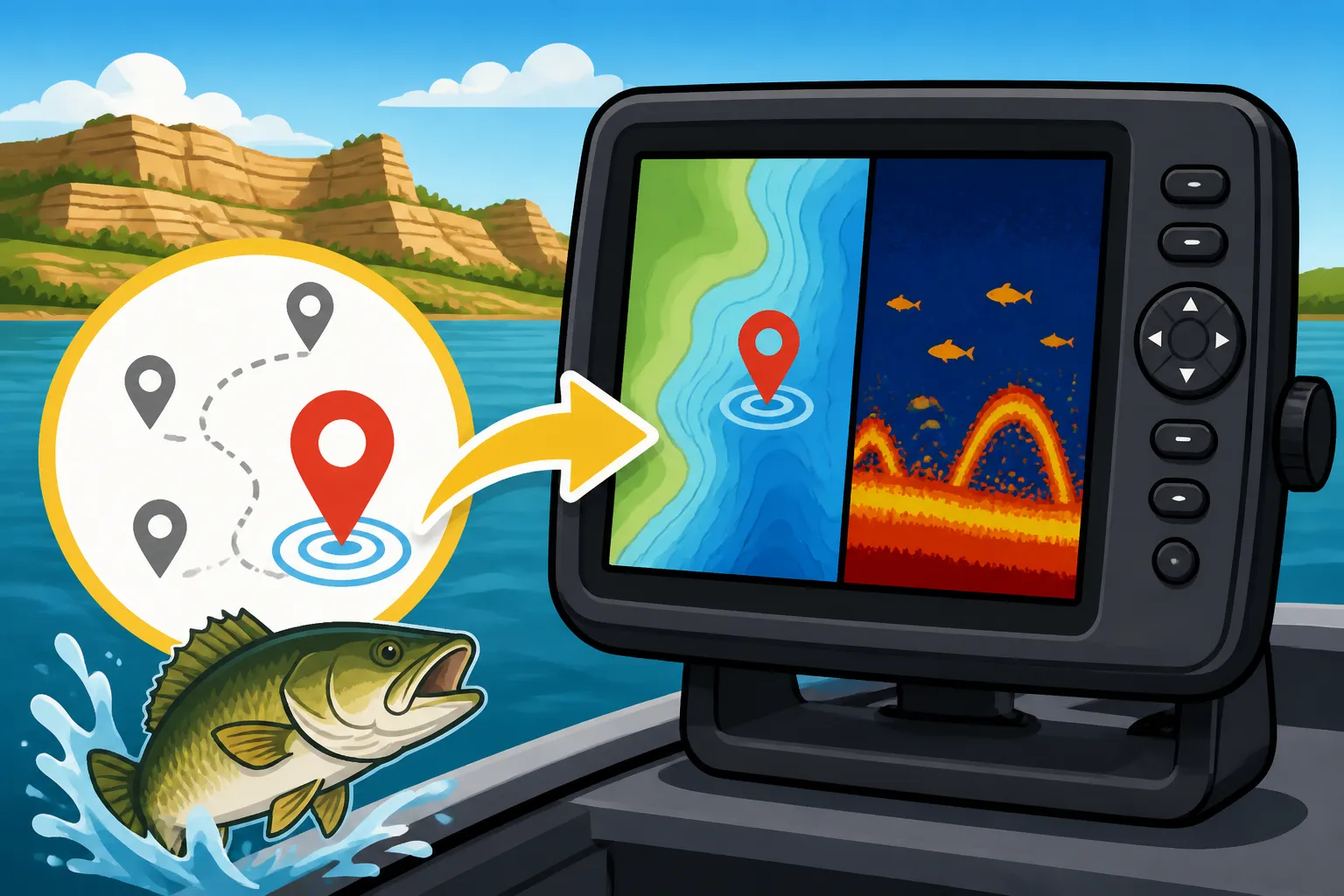
Marking a waypoint in real-time is like dropping an invisible anchor directly over that fish-holding structure. Whether it's a specific stump, a submerged point, an old roadbed, or even a school of suspended baitfish that's attracting predators, your fish finder can instantly log its GPS coordinates. This instant capture of location data means you're no longer relying on memory or landmarks that look different from different angles. It's precise, actionable information you can use immediately and for years to come.
Think about those days when the bite is tough, and you're struggling to locate fish. Then, finally, you stumble upon a school of yellow perch in a particular depth on Lake Kampeska. Without a waypoint, that discovery might be fleeting. With a waypoint, you now have a repeatable pattern. You can systematically check that spot on future trips, even under different conditions, and start to understand why fish are there. This builds your knowledge base and turns one-time luck into consistent success.
Building Your Personal Fishing Map
Over time, meticulously marking waypoints isn't just about saving individual spots; it's about building a comprehensive, personalized fishing map that tells a story of your time on the water. Each waypoint becomes a data point, contributing to a larger understanding of fish behavior, seasonal patterns, and preferred habitats in the areas you frequent. This is a powerful tool, far more valuable than any pre-programmed map chip.
Imagine having waypoints for every significant walleye hump you've found on the Missouri River, every submerged tree that held northern pike on Bitter Lake, or every deep pool where you've caught brown trout in Rapid Creek. Your fish finder effectively becomes a digital journal of your successes and observations. You can then review these spots on your computer at home, planning your next trip based on past experiences and current conditions.
This personal map becomes particularly useful when conditions change. For example, if you've marked a series of deeper rock piles that hold smallmouth bass in the summer, you might check shallower points near those same locations during the spring spawn. Conversely, if you've had great luck with ice fishing for walleye in a specific basin, your waypoints from open water fishing in the same area might reveal adjacent structures that become productive during other seasons. It's all about connecting the dots and continuously learning from your time spent on the water. How to Find Walleye on a New Lake becomes easier when you have a history of successful spots.
Understanding Your Fish Finder's Waypoint System
While different brands and models of fish finders might have slightly different interfaces, the core concept of marking and managing waypoints remains remarkably consistent. Most modern units, whether from popular brands like Garmin, Lowrance, or Humminbird, are designed with intuitive controls to make this process as seamless as possible, even when you're in the heat of the moment with a fish on the line.
The ability to mark waypoints is largely thanks to the integrated GPS (Global Positioning System) technology that's standard in almost all fish finders today. Your unit uses signals from satellites orbiting the Earth to pinpoint your exact latitude and longitude, often with incredible accuracy. When you "mark" a spot, it's essentially taking a snapshot of those GPS coordinates and saving them with a unique identifier. This digital precision is what makes waypoints so effective compared to trying to line up distant shore features.
If you're looking to upgrade or purchase your first unit, checking out options at places like Bass Pro Shops or online through Amazon can give you a great overview of the features available. Look for units that emphasize ease of use for waypoint marking, as this will be a crucial function for your fishing success. Best Fish Finders for South Dakota Lakes will definitely have robust waypoint capabilities.
The Basic Mechanics of Marking
At its heart, marking a waypoint usually involves a simple button press. Most fish finders have a dedicated "Mark" or "Waypoint" button, or an option within a quick-access menu. When you press this, the unit instantly records your current location. Depending on your unit's settings, it might automatically assign a generic name (like "Waypoint 001") and a default icon.
However, the real power comes from being able to customize these marks. Immediately after marking, or shortly thereafter, most units will allow you to edit the waypoint. This is where you can change the name to something descriptive, select a relevant icon (like a fish, a brush pile, or a rock), and even add notes. These small details are incredibly important for making your waypoints truly useful in the long run.
Think of it like this: "Waypoint 007" tells you nothing. "Walleye Hump 18ft Mid-Lake Oahe" is incredibly informative. Taking a few extra seconds to add these details will save you hours of confusion later on, especially when you accumulate hundreds of marks. Becoming familiar with your specific unit's menu structure for editing waypoints is a critical step in mastering this technique.
Different Types of Waypoints: Icons, Names, and Comments
Not all waypoints are created equal, and your fish finder often gives you the flexibility to differentiate them, making your personal map much more readable and useful. The three main elements you'll typically customize are the icon, the name, and any associated comments. Each plays a vital role in organizing your data.
Icons are visual shorthand. Most fish finders offer a library of symbols: a fish, an anchor, a submerged tree, a rock, a buoy, a danger sign, etc. Using these thoughtfully allows you to quickly discern what a waypoint represents at a glance when looking at your map screen. A string of fish icons might indicate a productive trolling run, while a group of rock icons could highlight a promising smallmouth bass habitat. These visual cues are especially helpful when you have a lot of waypoints clustered together.
Names are where you get specific. As mentioned, "Waypoint 007" isn't helpful. Instead, use names that immediately tell you what the spot is and why it's important. "Crappie Pile Joe Creek," "Walleye Hump North End," "Trout Hole Below Bridge," or "Salmon Trolling Lane Entry" are far more descriptive. Many units allow for alphanumeric entries, so you can even include depth, date, or specific lure notes if you wish. This specificity is crucial when planning future trips.
Comments or Notes provide the granular detail that can truly elevate a waypoint from a simple marker to a valuable piece of fishing intelligence. This is where you can jot down things like "Caught 5 walleye on crawler harness," "Brush pile 12-15ft, good in evenings," "Found suspended perch here 10ft down," or "Key depth: 22 feet, jigging spoons." Some advanced units even let you attach photos or specific sonar recordings to a waypoint, creating an even richer record. Utilizing all three of these elements will transform your waypoint library into an incredibly powerful fishing asset.
GPS Accuracy and How it Affects Your Marks
While modern GPS technology is remarkably precise, it's important to understand that no system is 100% perfect, and various factors can influence the accuracy of your waypoint marks. Most consumer-grade GPS receivers, including those in fish finders, typically offer accuracy within about 3 to 10 meters (10 to 30 feet) under ideal conditions. This is usually more than sufficient for fishing purposes, but it's good to be aware of potential nuances.
One key technology that significantly enhances GPS accuracy for many fish finders is WAAS (Wide Area Augmentation System) in North America, or its European counterpart, EGNOS. WAAS-enabled GPS receivers use correction signals from geostationary satellites to improve positional accuracy, often bringing it down to within a meter or two. If your fish finder supports WAAS, make sure it's enabled in your settings for the best possible precision. This is particularly valuable when marking small, isolated structures.
Factors that can degrade GPS accuracy include dense tree cover (not a huge issue on open South Dakota lakes, but relevant in some river sections), tall buildings (again, less common on the water), heavy cloud cover, and even solar flares (though these are rare and usually short-lived). Strong currents or fast boat speeds can also introduce slight discrepancies if you're marking while moving, as the boat may drift slightly between the moment you press the button and the system logs the full coordinates. Being aware of these elements can help you interpret your waypoints and understand why a spot might seem slightly off on occasion.
| Waypoint Naming Strategy | Description | Example Waypoint Name | Pros | Cons |
|---|---|---|---|---|
| Generic Auto-Assign | Default name assigned by the unit. | Waypoint 001 | Quickest to mark (no input needed). | Provides no useful information; quickly becomes confusing with multiple marks. |
| Simple Descriptive | Basic description of what was caught or found. | Walleye Hump | Better than generic; gives a general idea of the spot. | Lacks detail; many "Walleye Humps" can exist. |
| Detailed Descriptive | Includes species, structure type, location, depth. | Crappie Brush 15ft Joe Creek | Highly informative; easy to identify specific spots later; aids in pattern recognition. | Takes a few extra seconds to input; can be long on some unit displays. |
| Categorized/Numbered | Combines a category with a sequential number. | SPOT1 Walleye, SPOT2 Pike | Good for organizing similar spots; useful for large areas with many identical structures. | May still lack specific details unless combined with comments. |
| Seasonal/Conditional | Notes specific conditions or times it was productive. | Walleye Spring 12ft PM | Excellent for understanding patterns; helps predict future success. | Requires consistent input and knowledge of conditions. |
Step-by-Step Guide to Marking Waypoints in Real-Time
The real magic of waypoints happens when you're actively fishing. Being able to quickly and accurately mark a spot right when you discover it is paramount to making the most of your time on the water. It’s a skill that gets faster and more intuitive with practice, eventually becoming second nature. Whether you're pulling in a monster walleye on Lake Oahe or jigging for perch through the ice, the process is largely the same.
Before you even hit the water, take some time to familiarize yourself with your specific fish finder. Every unit has its own quirks. Find that "Mark" button or the menu option for waypoints. Practice pushing it when you're docked or in your driveway. Get comfortable with navigating to the edit screen for names and icons. The more you practice without pressure, the smoother it will be when a big fish is on the line, and you're trying to quickly log that productive spot. Knowing your unit inside and out is the first step in effective waypoint management.
Don't be afraid to mark everything that looks remotely interesting at first. You can always delete or refine waypoints later. It's better to have too many marks than to wish you had marked a spot that turned out to be a secret honey hole. As you gain experience, you'll develop an eye for what's truly worth saving.
Marking a Live Catch or Structure
This is the classic scenario: you're reeling in a fish, or your sonar screen just painted a perfect image of a submerged rock pile that you know will hold fish. This is the moment to mark! Most fish finders have a quick-access "Mark" button, often prominently displayed or accessible through a single press.
As soon as you notice something significant on your sonar screen, or a fish hits your lure, press that "Mark" button. The unit will instantly record the GPS coordinates of your boat at that precise moment. If you're drifting or trolling, it's often best to mark as soon as you get a bite, rather than waiting until the fish is in the boat, as your boat can move a considerable distance in a short time. For stationary structure, try to be directly over it when you mark. Many fish finders will automatically assign a generic name like "Waypoint 001." Don't worry about changing the name in the heat of the moment; just get the spot saved.
Once the fish is in the net, or the immediate excitement has passed, then take a moment to edit that waypoint. Navigate to your waypoint list or the specific waypoint you just created. Change the generic name to something descriptive, like "Walleye Break 25ft" or "Crappie Tree NE Shore." Assign a relevant icon, such as a fish or a brush pile. If your unit allows, add a quick note about the bait, depth, or time of day. This fast, two-stage process – mark first, edit second – is the most efficient way to capture those fleeting moments of success on the water.
Saving "Ghost" Waypoints from Sonar History
Sometimes, you might be driving along, not actively looking for spots, and a fantastic piece of structure or a school of fish flashes across your screen. Or maybe you were so focused on reeling in a fish that you forgot to hit the mark button until it was too late. Modern fish finders often come to the rescue with a feature called "sonar history" or "scroll back."
This feature allows you to rewind your sonar display, essentially looking back in time at what your transducer has already seen. If you missed marking a promising structure, you can scroll back through the history until you find that exact spot on your screen. Once you've located it, most units will have an option (often by moving a cursor over the desired spot and pressing "Enter" or "Menu") to "Mark Waypoint Here" or "Save Structure." This is incredibly useful for capturing those "ghost" images that you wish you'd saved live.
This function is a true lifesaver, especially on unfamiliar waters or when you're simply covering a lot of ground. You might see a subtle contour change or a small rock pile that you didn't initially think much of, but after a few minutes, realize it's exactly the kind of spot you're looking for. Being able to go back and mark it from your history ensures you don't miss out on potential honey holes. How to Read a Fish Finder for Walleye goes hand-in-hand with utilizing sonar history.
Naming and Categorizing Your Waypoints
This is where the organizational magic happens. A pile of generically named waypoints is almost as useless as no waypoints at all. Taking the time to properly name and categorize your marks will make them exponentially more valuable for future trips. Develop a system that works for you and stick to it!
A good naming convention includes key pieces of information: what you found, what species, and perhaps a general location. For example, instead of "WP 015," consider "Oahe Walleye Hump N," or "Sharpe Crappie Tree West Bend." If you're fishing smaller waters, you might include the lake name itself, like "Kampeska Perch Deep Edge." Some anglers even use codes, like "W-HMP" for walleye hump or "C-BRS" for crappie brush. The goal is clarity and quick identification.
Categorization can also involve using different icons for different species or structures. A fish icon might be for a spot where you actually caught fish, while a rock icon is for a promising structure that just looks fishy. Some advanced fish finders allow you to create custom groups or folders for waypoints, such as "Walleye Hotspots," "Crappie Piles," or "Trout Streams." This level of organization is invaluable when you've accumulated hundreds or even thousands of waypoints across various South Dakota fishing destinations. South Dakota Fishing Gear Checklist should always include understanding your fish finder's features for this reason.
Managing and Utilizing Your Waypoints for Future Success
Marking waypoints is only half the battle; the real benefit comes from effectively managing and utilizing them to inform your future fishing endeavors. A well-organized waypoint library is a treasure trove of past successes and potential future triumphs, a testament to your time spent exploring South Dakota's waters. Just like organizing your tackle box for different species, (see How to Organize a Tackle Box for Walleye Fishing), managing your waypoints keeps your fishing efforts efficient.
Think of your waypoints as a dynamic, evolving database. It's not just a static list; it's a living record that grows with your experience. Periodically reviewing your waypoints, especially during the off-season or before a trip to a familiar lake, can spark new ideas and strategies. You might notice patterns you hadn't seen before, or remember a spot that was productive in a specific season that you've since forgotten. This proactive management is key to unlocking their full potential.
Don't be afraid to experiment with your waypoints. If a spot that was once hot isn't producing, try approaching it from a different angle, fishing it at a different time of day, or with a different presentation. Your waypoints are starting points, not guarantees. They give you a precise location to begin your investigation, allowing you to fine-tune your techniques and adapt to changing conditions.
Reviewing and Editing Your Waypoint Library
Even the most carefully marked waypoint can benefit from review and refinement. Over time, you'll naturally accumulate a lot of marks, some more valuable than others. Regularly reviewing your waypoint library is like decluttering your fishing space – it makes everything more accessible and useful.
Navigate to your waypoint list on your fish finder. Many units allow you to sort waypoints by name, distance from current location, or date created. Look for waypoints that have generic names or are no longer relevant (e.g., a "fish" icon from a fluke encounter that didn't lead to a pattern). You can edit these, adding more detail if you now remember what made the spot special, or simply delete them if they're clutter. This keeps your library clean and focused on productive spots.
Consider adding notes or updating existing notes on waypoints as you gain more experience with them. If you marked a "Walleye Hump" in May and found it great for jigging, but in August you discovered it was better for trolling crankbaits, update the notes to reflect that. This continuous refinement builds a truly intelligent database of fishing knowledge. Many units also allow you to export your waypoints to an SD card, which is a great way to back up your data or view them on a computer with mapping software, letting you manage them on a bigger screen.
Navigating Back to Saved Spots
This is the moment of truth – using your marked waypoints to return to a previously productive location. Modern fish finders make this incredibly easy, essentially turning your boat into a guided missile to your chosen spot.
Once you've selected a waypoint from your list, most units will offer an option like "Go To," "Navigate," or "Create Route To." Selecting this will typically display a directional arrow on your map screen, indicating the bearing to your chosen waypoint. Your unit will also show you the distance to the waypoint and often a "cross-track error" or "off course" indicator, telling you how far left or right you are from your direct path. South Dakota Boat Safety Requirements always suggest knowing how to use your navigation tools effectively, and waypoints are a crucial part of that.
As you approach the waypoint, keep an eye on your map. It’s a good practice to slow down when you're within about 50-100 yards of your target. This allows you to drift or slowly motor over the exact spot, verifying it on your sonar screen before you start fishing. Remember that GPS accuracy isn't perfect, so the waypoint might put you within a few feet of the precise location. Use your sonar to fine-tune your position, looking for the specific structure or fish that made the spot productive in the first place.
Sharing and Transferring Waypoints
Sometimes, you'll want to share your hard-earned fishing intel with a buddy, or perhaps transfer waypoints from an old fish finder to a new one. Many modern units offer options for this, usually through an SD card or network connection.
Most mid-to-high-end fish finders have an SD card slot. You can typically export your waypoints to a memory card in a universal format (like GPX) or a proprietary format specific to your unit's brand. This is an excellent way to back up your data, ensuring you don't lose all your valuable spots if your unit ever fails. You can then import these waypoints into another compatible fish finder or even into PC-based mapping software. If you're looking for new gear, Amazon offers a wide selection of SD cards that would work for this purpose.
For boats with multiple networked units, like a console unit and a bow-mount unit, waypoints are often shared seamlessly across the network. Mark a spot on your console unit, and it immediately appears on your bow-mount unit. This is incredibly convenient for anglers who move around the boat while fishing. Always check your specific fish finder's manual for detailed instructions on exporting, importing, and sharing waypoints, as the process can vary slightly between manufacturers.
Syncing with Online Tools (Optional but helpful)
In today's connected world, some advanced fish finders and mapping systems offer the ability to sync your waypoints with online platforms or mobile apps. While not strictly necessary for basic waypoint use, these tools can provide an extra layer of convenience and analytical power.
Brands like Humminbird, for instance, have systems that allow you to upload your waypoints and tracks to a cloud-based account. This means you can access your fishing data from your smartphone, tablet, or home computer. You can review your day's fishing, analyze patterns, plan future trips, and even share specific waypoints with trusted fishing partners directly through the app. This can be especially useful for South Dakota Walleye Fishing Guide trips that span multiple days or locations.
These online tools often integrate with high-definition mapping, allowing you to see your waypoints overlaid on detailed contour maps. This can help you identify deeper connections between various spots that might not be obvious on a smaller fish finder screen. While these features often come with a subscription or are part of higher-end units, they represent the cutting edge of fishing technology, turning your basic waypoints into a comprehensive digital fishing log.
Disclaimer
This article is for general informational purposes only and does not constitute professional advice. Laws, prices and regulations vary by location and change over time. Consult a qualified professional for guidance on your specific situation.